SPOKANE, Wash.– Winter weather arrived in the mountains of North Idaho Tuesday as snow fell on Lookout Pass (Elevation 4711′).
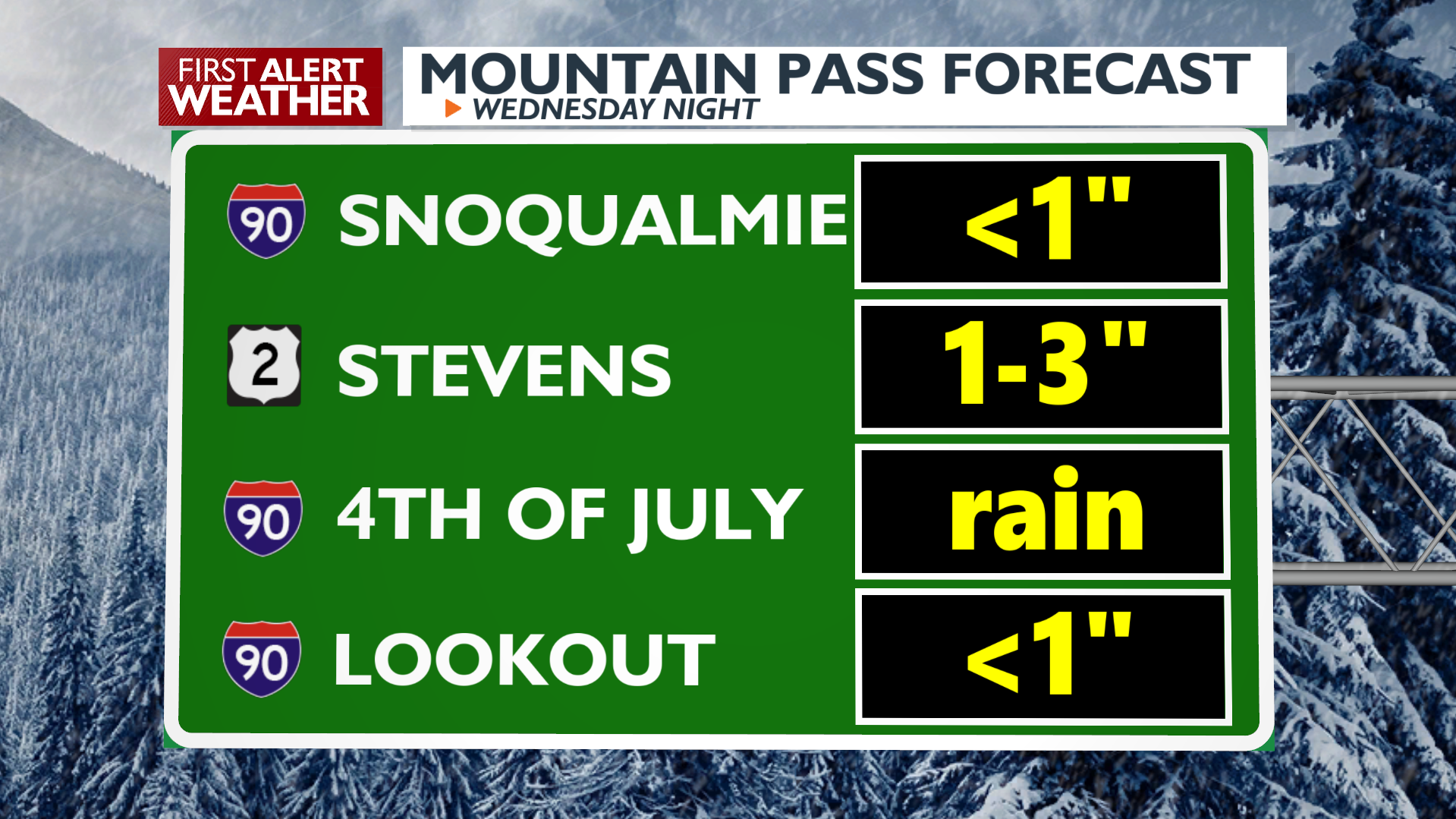
While this may only be a dusting, more snow is to come for many mountain passes with another storm later this week. That storm begins Wednesday night in the Cascades, where up to 5 inches of snow will fall at Washington Pass on the North Cascades Highway through midday Thursday. Other passes in the Cascades area like Blewett Pass and Stevens Pass will see up to 3 inches of snow during the same period. Sherman Pass will see up to 4 inches.
Snoqualmie Pass will get off easy by comparison with a slushy inch expected Wednesday night. Lookout Pass will also see up to another inch of snow during the same time period. More snow is likely for these passes later in the week as the wet weather pattern continues.
Snow is also falling at local ski areas. Schweitzer reported their first notable snowfall of the season on Tuesday. Additional snow will be possible at local ski hills through the start of the weekend.
COPYRIGHT 2024 BY KXLY. ALL RIGHTS RESERVED. THIS MATERIAL MAY NOT BE PUBLISHED, BROADCAST, REWRITTEN OR REDISTRIBUTED.